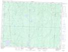
Maps showing Ruisseau Gauthier, La Morandière; Abitibi, Quebec
Ruisseau Gauthier is a River located in La Morandière; Abitibi, Quebec and has an elevation of 303 meters.
- Latitude: 48° 45' 3'' North (decimal: 48.7508333)
- Longitude: 77° 38' 52'' West (decimal: -77.6477778)
- Topography Feature Category: River
- Geographical Feature: Ruisseau
- Canadian Province/Territory: Quebec
- Elevation: 303 meters
- Location: La Morandière; Abitibi
- Atlas of Canada Locator Map: Ruisseau Gauthier
- GPS Coordinate Locator Map: Ruisseau Gauthier Lat/Long
Ruisseau Gauthier NTS Map Sheets