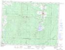
Maps showing Ruisseau Pelchat, Landrienne; Abitibi, Quebec
Ruisseau Pelchat is a River located in Landrienne; Abitibi, Quebec and has an elevation of 306 meters.
- Latitude: 48° 30' 17'' North (decimal: 48.5048138)
- Longitude: 77° 57' 20'' West (decimal: -77.9555941)
- Topography Feature Category: River
- Geographical Feature: Ruisseau
- Canadian Province/Territory: Quebec
- Elevation: 306 meters
- Location: Landrienne; Abitibi
- Atlas of Canada Locator Map: Ruisseau Pelchat
- GPS Coordinate Locator Map: Ruisseau Pelchat Lat/Long
Ruisseau Pelchat NTS Map Sheets