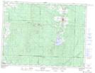
Maps showing Cours d'eau Gendron, Barraute; Abitibi, Quebec
Cours d'eau Gendron is a River located in Barraute; Abitibi, Quebec.
- Latitude: 48° 30' 6'' North (decimal: 48.5016667)
- Longitude: 77° 40' 16'' West (decimal: -77.6711111)
- Topography Feature Category: River
- Geographical Feature: Cours d'eau agricole
- Canadian Province/Territory: Quebec
- Location: Barraute; Abitibi
- Atlas of Canada Locator Map: Cours d'eau Gendron
- GPS Coordinate Locator Map: Cours d'eau Gendron Lat/Long
Cours d'eau Gendron NTS Map Sheets