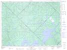
Maps showing Kanikikotciskak, La Tuque; Le Haut-Saint-Maurice, Quebec
Kanikikotciskak is a Lake located in La Tuque; Le Haut-Saint-Maurice, Quebec.
- Latitude: 47° 39' 32'' North (decimal: 47.6588889)
- Longitude: 74° 2' 16'' West (decimal: -74.0377778)
- Topography Feature Category: Lake
- Geographical Feature: Lac
- Canadian Province/Territory: Quebec
- Location: La Tuque; Le Haut-Saint-Maurice
- GPS Coordinate Locator Map: Kanikikotciskak Lat/Long
Kanikikotciskak NTS Map Sheets