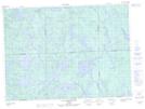
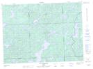
Maps showing Île des Garde-Feu, Rivière-Kipawa; Témiscamingue, Quebec
Île des Garde-Feu is a Island located in Rivière-Kipawa; Témiscamingue, Quebec.
- Latitude: 47° 15' 8'' North (decimal: 47.2522222)
- Longitude: 78° 18' 14'' West (decimal: -78.3038889)
- Topography Feature Category: Island
- Geographical Feature: Île / Ile
- Canadian Province/Territory: Quebec
- Location: Rivière-Kipawa; Témiscamingue
- Atlas of Canada Locator Map: Île des Garde-Feu
- GPS Coordinate Locator Map: Île des Garde-Feu Lat/Long
Île des Garde-Feu NTS Map Sheets