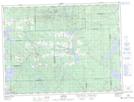
Maps showing Île Gilbert, Rouyn-Noranda; Rouyn-Noranda, Quebec
Île Gilbert is a Cape located in Rouyn-Noranda; Rouyn-Noranda, Quebec and has an elevation of 275 meters.
- Latitude: 48° 22' 11'' North (decimal: 48.3697222)
- Longitude: 78° 42' 13'' West (decimal: -78.7036110)
- Topography Feature Category: Cape
- Geographical Feature: Presqu'île
- Canadian Province/Territory: Quebec
- Elevation: 275 meters
- Location: Rouyn-Noranda; Rouyn-Noranda
- Atlas of Canada Locator Map: Île Gilbert
- GPS Coordinate Locator Map: Île Gilbert Lat/Long
Île Gilbert NTS Map Sheets