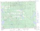
Maps showing Première Île, Rouyn-Noranda; Rouyn-Noranda, Quebec
Première Île is a Island located in Rouyn-Noranda; Rouyn-Noranda, Quebec and has an elevation of 277 meters.
- Latitude: 48° 25' 6'' North (decimal: 48.4183333)
- Longitude: 78° 59' 5'' West (decimal: -78.9847222)
- Topography Feature Category: Island
- Geographical Feature: Île / Ile
- Canadian Province/Territory: Quebec
- Elevation: 277 meters
- Location: Rouyn-Noranda; Rouyn-Noranda
- Atlas of Canada Locator Map: Première Île
- GPS Coordinate Locator Map: Première Île Lat/Long
Première Île NTS Map Sheets