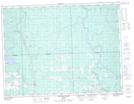
Maps showing Ruisseau Lachance, Berry; Abitibi, Quebec
Ruisseau Lachance is a River located in Berry; Abitibi, Quebec and has an elevation of 304 meters.
- Latitude: 48° 43' 16'' North (decimal: 48.7212025)
- Longitude: 78° 14' 56'' West (decimal: -78.2489401)
- Topography Feature Category: River
- Geographical Feature: Ruisseau
- Canadian Province/Territory: Quebec
- Elevation: 304 meters
- Location: Berry; Abitibi
- Atlas of Canada Locator Map: Ruisseau Lachance
- GPS Coordinate Locator Map: Ruisseau Lachance Lat/Long
Ruisseau Lachance NTS Map Sheets