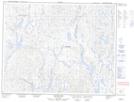
Maps showing Mont Kapiskuapusteht, Lac-Jérôme; Minganie, Quebec
Mont Kapiskuapusteht is a Mountain located in Lac-Jérôme; Minganie, Quebec.
- Latitude: 51° 33' 41'' North (decimal: 51.5614538)
- Longitude: 64° 2' 21'' West (decimal: -64.0392908)
- Topography Feature Category: Mountain
- Geographical Feature: Mont
- Canadian Province/Territory: Quebec
- Location: Lac-Jérôme; Minganie
- Atlas of Canada Locator Map: Mont Kapiskuapusteht
- GPS Coordinate Locator Map: Mont Kapiskuapusteht Lat/Long
Mont Kapiskuapusteht NTS Map Sheets