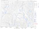
Maps showing Lac Kaministukuakamaht, Lac-Jérôme; Minganie, Quebec
Lac Kaministukuakamaht is a Lake located in Lac-Jérôme; Minganie, Quebec.
- Latitude: 51° 39' 35'' North (decimal: 51.6597859)
- Longitude: 64° 12' 18'' West (decimal: -64.2051288)
- Topography Feature Category: Lake
- Geographical Feature: Lac
- Canadian Province/Territory: Quebec
- Location: Lac-Jérôme; Minganie
- Atlas of Canada Locator Map: Lac Kaministukuakamaht
- GPS Coordinate Locator Map: Lac Kaministukuakamaht Lat/Long
Lac Kaministukuakamaht NTS Map Sheets