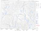
Maps showing Lac Mista Uauahk, Lac-Jérôme; Minganie, Quebec
Lac Mista Uauahk is a Lake located in Lac-Jérôme; Minganie, Quebec.
- Latitude: 51° 34' 59'' North (decimal: 51.5831203)
- Longitude: 64° 7' 49'' West (decimal: -64.1304053)
- Topography Feature Category: Lake
- Geographical Feature: Lac
- Canadian Province/Territory: Quebec
- Location: Lac-Jérôme; Minganie
- Atlas of Canada Locator Map: Lac Mista Uauahk
- GPS Coordinate Locator Map: Lac Mista Uauahk Lat/Long
Lac Mista Uauahk NTS Map Sheets