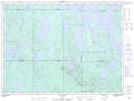
Maps showing Tomawapocokanan, La Tuque; Le Haut-Saint-Maurice, Quebec
Tomawapocokanan is a Unincorporated area located in La Tuque; Le Haut-Saint-Maurice, Quebec.
- Latitude: 48° 21' 14'' North (decimal: 48.3538889)
- Longitude: 74° 38' 28'' West (decimal: -74.6411111)
- Topography Feature Category: Unincorporated area
- Geographical Feature: Lieu-dit
- Canadian Province/Territory: Quebec
- Location: La Tuque; Le Haut-Saint-Maurice
- Atlas of Canada Locator Map: Tomawapocokanan
- GPS Coordinate Locator Map: Tomawapocokanan Lat/Long
Tomawapocokanan NTS Map Sheets