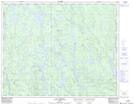
Maps showing Kamatshiskueut Uhakamehim, Lac-Jérôme; Minganie, Quebec
Kamatshiskueut Uhakamehim is a Unincorporated area located in Lac-Jérôme; Minganie, Quebec.
- Latitude: 51° 31' 57'' North (decimal: 51.5325564)
- Longitude: 63° 4' 1'' West (decimal: -63.0670194)
- Topography Feature Category: Unincorporated area
- Geographical Feature: Lieu-dit
- Canadian Province/Territory: Quebec
- Location: Lac-Jérôme; Minganie
- Atlas of Canada Locator Map: Kamatshiskueut Uhakamehim
- GPS Coordinate Locator Map: Kamatshiskueut Uhakamehim Lat/Long
Kamatshiskueut Uhakamehim NTS Map Sheets