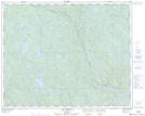
Maps showing Mont Kapiskuahkatnau, Lac-Jérôme; Minganie, Quebec
Mont Kapiskuahkatnau is a Mountain located in Lac-Jérôme; Minganie, Quebec and has an elevation of 661 meters.
- Latitude: 51° 43' 58'' North (decimal: 51.7327778)
- Longitude: 62° 58' 16'' West (decimal: -62.9711111)
- Topography Feature Category: Mountain
- Geographical Feature: Mont
- Canadian Province/Territory: Quebec
- Elevation: 661 meters
- Location: Lac-Jérôme; Minganie
- Atlas of Canada Locator Map: Mont Kapiskuahkatnau
- GPS Coordinate Locator Map: Mont Kapiskuahkatnau Lat/Long
Mont Kapiskuahkatnau NTS Map Sheets