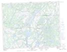
Maps showing Presqu'île Mahtihantshuapis Tatakuahk, Petit-Mécatina; Minganie, Quebec
Presqu'île Mahtihantshuapis Tatakuahk is a Cape located in Petit-Mécatina; Minganie, Quebec and has an elevation of 70 meters.
- Latitude: 50° 23' 4'' North (decimal: 50.3845058)
- Longitude: 60° 16' 56'' West (decimal: -60.2822490)
- Topography Feature Category: Cape
- Geographical Feature: Presqu'île
- Canadian Province/Territory: Quebec
- Elevation: 70 meters
- Location: Petit-Mécatina; Minganie
- Atlas of Canada Locator Map: Presqu'île Mahtihantshuapis Tatakuahk
- GPS Coordinate Locator Map: Presqu'île Mahtihantshuapis Tatakuahk Lat/Long
Presqu'île Mahtihantshuapis Tatakuahk NTS Map Sheets