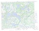
Maps showing Lac Pun Itis Umiskumim, Petit-Mécatina; Minganie, Quebec
Lac Pun Itis Umiskumim is a Lake located in Petit-Mécatina; Minganie, Quebec and has an elevation of 108 meters.
- Latitude: 50° 28' 25'' North (decimal: 50.4736741)
- Longitude: 60° 35' 59'' West (decimal: -60.5997626)
- Topography Feature Category: Lake
- Geographical Feature: Lac
- Canadian Province/Territory: Quebec
- Elevation: 108 meters
- Location: Petit-Mécatina; Minganie
- Atlas of Canada Locator Map: Lac Pun Itis Umiskumim
- GPS Coordinate Locator Map: Lac Pun Itis Umiskumim Lat/Long
Lac Pun Itis Umiskumim NTS Map Sheets