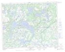
Maps showing Mistamahkuhua, Petit-Mécatina; Minganie, Quebec
Mistamahkuhua is a Unincorporated area located in Petit-Mécatina; Minganie, Quebec and has an elevation of 17 meters.
- Latitude: 50° 21' 54'' North (decimal: 50.3650650)
- Longitude: 60° 44' 14'' West (decimal: -60.7372705)
- Topography Feature Category: Unincorporated area
- Geographical Feature: Lieu-dit
- Canadian Province/Territory: Quebec
- Elevation: 17 meters
- Location: Petit-Mécatina; Minganie
- Atlas of Canada Locator Map: Mistamahkuhua
- GPS Coordinate Locator Map: Mistamahkuhua Lat/Long
Mistamahkuhua NTS Map Sheets