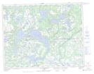
Maps showing Lac Matakahp, Petit-Mécatina; Minganie, Quebec
Lac Matakahp is a Lake located in Petit-Mécatina; Minganie, Quebec and has an elevation of 126 meters.
- Latitude: 50° 29' 45'' North (decimal: 50.4958960)
- Longitude: 60° 34' 23'' West (decimal: -60.5730942)
- Topography Feature Category: Lake
- Geographical Feature: Lac
- Canadian Province/Territory: Quebec
- Elevation: 126 meters
- Location: Petit-Mécatina; Minganie
- Atlas of Canada Locator Map: Lac Matakahp
- GPS Coordinate Locator Map: Lac Matakahp Lat/Long
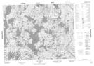
Lac Matakahp NTS Map Sheets