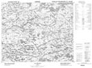
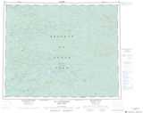
Maps showing Lac Elin Utataun, Baie-James; Jamésie, Quebec
Lac Elin Utataun is a Lake located in Baie-James; Jamésie, Quebec.
- Latitude: 52° 45' 18'' North (decimal: 52.755)
- Longitude: 74° 40' 20'' West (decimal: -74.6722222)
- Topography Feature Category: Lake
- Geographical Feature: Lac
- Canadian Province/Territory: Quebec
- Location: Baie-James; Jamésie
- Atlas of Canada Locator Map: Lac Elin Utataun
- GPS Coordinate Locator Map: Lac Elin Utataun Lat/Long
Lac Elin Utataun NTS Map Sheets