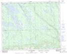
Maps showing Portage Kamuashkumesht, Rivière-Mouchalagane; Caniapiscau, Quebec
Portage Kamuashkumesht is a Road feature located in Rivière-Mouchalagane; Caniapiscau, Quebec.
- Latitude: 51° 51' 38'' North (decimal: 51.8605555)
- Longitude: 67° 6' 48'' West (decimal: -67.1133332)
- Topography Feature Category: Road feature
- Geographical Feature: Portage
- Canadian Province/Territory: Quebec
- Location: Rivière-Mouchalagane; Caniapiscau
- Atlas of Canada Locator Map: Portage Kamuashkumesht
- GPS Coordinate Locator Map: Portage Kamuashkumesht Lat/Long
Portage Kamuashkumesht NTS Map Sheets