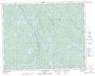
Maps showing Ruisseau Kaupasht, Lac-Walker; Sept-Rivières, Quebec
Ruisseau Kaupasht is a River located in Lac-Walker; Sept-Rivières, Quebec and has an elevation of 531 meters.
- Latitude: 51° 18' 43'' North (decimal: 51.3119444)
- Longitude: 67° 16' 8'' West (decimal: -67.2688889)
- Topography Feature Category: River
- Geographical Feature: Ruisseau
- Canadian Province/Territory: Quebec
- Elevation: 531 meters
- Location: Lac-Walker; Sept-Rivières
- Atlas of Canada Locator Map: Ruisseau Kaupasht
- GPS Coordinate Locator Map: Ruisseau Kaupasht Lat/Long
Ruisseau Kaupasht NTS Map Sheets