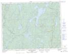
Maps showing Uashatuess, Lac-Walker; Sept-Rivières, Quebec
Uashatuess is a Unincorporated area located in Lac-Walker; Sept-Rivières, Quebec and has an elevation of 350 meters.
- Latitude: 51° 2' 20'' North (decimal: 51.0388889)
- Longitude: 66° 56' 5'' West (decimal: -66.9347222)
- Topography Feature Category: Unincorporated area
- Geographical Feature: Lieu-dit
- Canadian Province/Territory: Quebec
- Elevation: 350 meters
- Location: Lac-Walker; Sept-Rivières
- Atlas of Canada Locator Map: Uashatuess
- GPS Coordinate Locator Map: Uashatuess Lat/Long
Uashatuess NTS Map Sheets