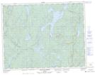
Maps showing Île Kainupekutisht, Lac-Walker; Sept-Rivières, Quebec
Île Kainupekutisht is a Island located in Lac-Walker; Sept-Rivières, Quebec and has an elevation of 372 meters.
- Latitude: 51° 13' 42'' North (decimal: 51.2283333)
- Longitude: 66° 56' 58'' West (decimal: -66.9494444)
- Topography Feature Category: Island
- Geographical Feature: Île / Ile
- Canadian Province/Territory: Quebec
- Elevation: 372 meters
- Location: Lac-Walker; Sept-Rivières
- Atlas of Canada Locator Map: Île Kainupekutisht
- GPS Coordinate Locator Map: Île Kainupekutisht Lat/Long
Île Kainupekutisht NTS Map Sheets