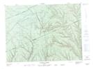
Maps showing Camp des Fourches, Rivière-Nouvelle; Avignon, Quebec
Camp des Fourches is a Natural resources site located in Rivière-Nouvelle; Avignon, Quebec.
- Latitude: 48° 18' 13'' North (decimal: 48.3036593)
- Longitude: 66° 30' 38'' West (decimal: -66.5105133)
- Topography Feature Category: Natural resources site
- Geographical Feature: Camp forestier
- Canadian Province/Territory: Quebec
- Location: Rivière-Nouvelle; Avignon
- Atlas of Canada Locator Map: Camp des Fourches
- GPS Coordinate Locator Map: Camp des Fourches Lat/Long
Camp des Fourches NTS Map Sheets