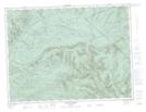
Maps showing Ruisseau Barren Inférieur, Rivière-Bonjour; Matane, Quebec
Ruisseau Barren Inférieur is a River located in Rivière-Bonjour; Matane, Quebec.
- Latitude: 48° 41' 20'' North (decimal: 48.6889353)
- Longitude: 66° 23' 35'' West (decimal: -66.3930126)
- Topography Feature Category: River
- Geographical Feature: Ruisseau
- Canadian Province/Territory: Quebec
- Location: Rivière-Bonjour; Matane
- Atlas of Canada Locator Map: Ruisseau Barren Inférieur
- GPS Coordinate Locator Map: Ruisseau Barren Inférieur Lat/Long