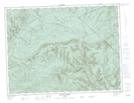
Maps showing Lac Rouge, Ruisseau-des-Mineurs; La Matapédia, Quebec
Lac Rouge is a Lake located in Ruisseau-des-Mineurs; La Matapédia, Quebec and has an elevation of 298 meters.
- Latitude: 48° 37' 44'' North (decimal: 48.6289350)
- Longitude: 66° 26' 2'' West (decimal: -66.4338465)
- Topography Feature Category: Lake
- Geographical Feature: Lac
- Canadian Province/Territory: Quebec
- Elevation: 298 meters
- Location: Ruisseau-des-Mineurs; La Matapédia
- Atlas of Canada Locator Map: Lac Rouge
- GPS Coordinate Locator Map: Lac Rouge Lat/Long