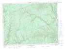
Maps showing Coulée à Wilfrid-McBoarty, Rivière-Nouvelle; Avignon, Quebec
Coulée à Wilfrid-McBoarty is a Valley located in Rivière-Nouvelle; Avignon, Quebec.
- Latitude: 48° 21' 47'' North (decimal: 48.3631034)
- Longitude: 66° 23' 29'' West (decimal: -66.3913428)
- Topography Feature Category: Valley
- Geographical Feature: Ravin
- Canadian Province/Territory: Quebec
- Location: Rivière-Nouvelle; Avignon
- Atlas of Canada Locator Map: Coulée à Wilfrid-McBoarty
- GPS Coordinate Locator Map: Coulée à Wilfrid-McBoarty Lat/Long
Coulée à Wilfrid-McBoarty NTS Map Sheets