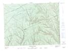
Maps showing Le Vingt-Quatre, Ruisseau-des-Mineurs; La Matapédia, Quebec
Le Vingt-Quatre is a Unincorporated area located in Ruisseau-des-Mineurs; La Matapédia, Quebec.
- Latitude: 48° 28' 45'' North (decimal: 48.4792138)
- Longitude: 66° 50' 49'' West (decimal: -66.8469158)
- Topography Feature Category: Unincorporated area
- Geographical Feature: Lieu-dit
- Canadian Province/Territory: Quebec
- Location: Ruisseau-des-Mineurs; La Matapédia
- Atlas of Canada Locator Map: Le Vingt-Quatre
- GPS Coordinate Locator Map: Le Vingt-Quatre Lat/Long
Le Vingt-Quatre NTS Map Sheets