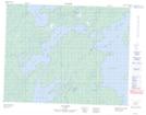
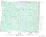
Maps showing Rocher Amiskuwist, Baie-James; Jamésie, Quebec
Rocher Amiskuwist is a Island located in Baie-James; Jamésie, Quebec.
- Latitude: 50° 52' 45'' North (decimal: 50.8791667)
- Longitude: 77° 6' 23'' West (decimal: -77.1063889)
- Topography Feature Category: Island
- Geographical Feature: Rocher
- Canadian Province/Territory: Quebec
- Location: Baie-James; Jamésie
- Atlas of Canada Locator Map: Rocher Amiskuwist
- GPS Coordinate Locator Map: Rocher Amiskuwist Lat/Long