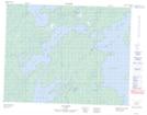
Maps showing Rivière Iyinu Kaniput, Baie-James; Jamésie, Quebec
Rivière Iyinu Kaniput is a River located in Baie-James; Jamésie, Quebec.
- Latitude: 50° 49' 49'' North (decimal: 50.8302778)
- Longitude: 77° 22' 39'' West (decimal: -77.3774999)
- Topography Feature Category: River
- Geographical Feature: Rivière
- Canadian Province/Territory: Quebec
- Location: Baie-James; Jamésie
- Atlas of Canada Locator Map: Rivière Iyinu Kaniput
- GPS Coordinate Locator Map: Rivière Iyinu Kaniput Lat/Long