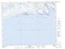
Maps showing Île Tshiahkuehihat, Côte-Nord-du-Golfe-du-Saint-Laurent; Basse-Côte-Nord, Quebec
Île Tshiahkuehihat is a Island located in Côte-Nord-du-Golfe-du-Saint-Laurent; Basse-Côte-Nord, Quebec and has an elevation of 0 meters.
- Latitude: 50° 10' 49'' North (decimal: 50.1803467)
- Longitude: 61° 6' 5'' West (decimal: -61.1014535)
- Topography Feature Category: Island
- Geographical Feature: Île / Ile
- Canadian Province/Territory: Quebec
- Elevation: 0 meters
- Location: Côte-Nord-du-Golfe-du-Saint-Laurent; Basse-Côte-Nord
- Atlas of Canada Locator Map: Île Tshiahkuehihat
- GPS Coordinate Locator Map: Île Tshiahkuehihat Lat/Long