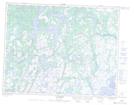
Maps showing Lacs Uhatshimihukup, Petit-Mécatina; Minganie, Quebec
Lacs Uhatshimihukup is a Lake located in Petit-Mécatina; Minganie, Quebec and has an elevation of 95 meters.
- Latitude: 50° 33' 58'' North (decimal: 50.5661709)
- Longitude: 59° 59' 0'' West (decimal: -59.9833411)
- Topography Feature Category: Lake
- Geographical Feature: Lacs
- Canadian Province/Territory: Quebec
- Elevation: 95 meters
- Location: Petit-Mécatina; Minganie
- Atlas of Canada Locator Map: Lacs Uhatshimihukup
- GPS Coordinate Locator Map: Lacs Uhatshimihukup Lat/Long
Lacs Uhatshimihukup NTS Map Sheets