Maps showing Ruisseau Yachisakw, Baie-d'Hudson; Kativik, Quebec
Ruisseau Yachisakw is a River located in Baie-d'Hudson; Kativik, Quebec.
- Latitude: 55° 2' 41'' North (decimal: 55.0447222)
- Longitude: 76° 6' 22'' West (decimal: -76.1061111)
- Topography Feature Category: River
- Geographical Feature: Ruisseau
- Canadian Province/Territory: Quebec
- Location: Baie-d'Hudson; Kativik
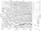
- Atlas of Canada Locator Map: Ruisseau Yachisakw
- GPS Coordinate Locator Map: Ruisseau Yachisakw Lat/Long
Ruisseau Yachisakw NTS Map Sheets