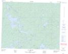
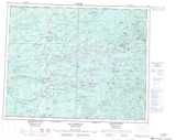
Maps showing Lac Kachimaskuwanahikanuch, Baie-James; Jamésie, Quebec
Lac Kachimaskuwanahikanuch is a Lake located in Baie-James; Jamésie, Quebec.
- Latitude: 51° 12' 8'' North (decimal: 51.2022222)
- Longitude: 76° 52' 4'' West (decimal: -76.8677778)
- Topography Feature Category: Lake
- Geographical Feature: Lac
- Canadian Province/Territory: Quebec
- Location: Baie-James; Jamésie
- Atlas of Canada Locator Map: Lac Kachimaskuwanahikanuch
- GPS Coordinate Locator Map: Lac Kachimaskuwanahikanuch Lat/Long
Lac Kachimaskuwanahikanuch NTS Map Sheets