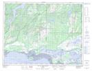
Maps showing Lac Kaiskuateu, Havre-Saint-Pierre; Minganie, Quebec
Lac Kaiskuateu is a Lake located in Havre-Saint-Pierre; Minganie, Quebec.
- Latitude: 50° 25' 53'' North (decimal: 50.4313889)
- Longitude: 63° 53' 31'' West (decimal: -63.8919444)
- Topography Feature Category: Lake
- Geographical Feature: Lac
- Canadian Province/Territory: Quebec
- Location: Havre-Saint-Pierre; Minganie
- Atlas of Canada Locator Map: Lac Kaiskuateu
- GPS Coordinate Locator Map: Lac Kaiskuateu Lat/Long
Lac Kaiskuateu NTS Map Sheets