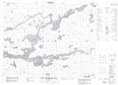
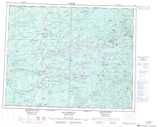
Maps showing Pointe Kamachisteweyapustech, Baie-James; Jamésie, Quebec
Pointe Kamachisteweyapustech is a Cape located in Baie-James; Jamésie, Quebec.
- Latitude: 51° 29' 43'' North (decimal: 51.4952778)
- Longitude: 76° 30' 30'' West (decimal: -76.5083333)
- Topography Feature Category: Cape
- Geographical Feature: Pointe
- Canadian Province/Territory: Quebec
- Location: Baie-James; Jamésie
- Atlas of Canada Locator Map: Pointe Kamachisteweyapustech
- GPS Coordinate Locator Map: Pointe Kamachisteweyapustech Lat/Long
Pointe Kamachisteweyapustech NTS Map Sheets