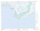
Maps showing Lacs Kanekauakamat, Natashquan; Minganie, Quebec
Lacs Kanekauakamat is a Lake located in Natashquan; Minganie, Quebec and has an elevation of 15 meters.
- Latitude: 50° 11' 42'' North (decimal: 50.1950711)
- Longitude: 61° 43' 14'' West (decimal: -61.7206441)
- Topography Feature Category: Lake
- Geographical Feature: Lacs
- Canadian Province/Territory: Quebec
- Elevation: 15 meters
- Location: Natashquan; Minganie
- Atlas of Canada Locator Map: Lacs Kanekauakamat
- GPS Coordinate Locator Map: Lacs Kanekauakamat Lat/Long
Lacs Kanekauakamat NTS Map Sheets