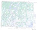
Maps showing Pointe Kaniauakaht, Petit-Mécatina; Minganie, Quebec
Pointe Kaniauakaht is a Cape located in Petit-Mécatina; Minganie, Quebec and has an elevation of 66 meters.
- Latitude: 50° 40' 3'' North (decimal: 50.6675594)
- Longitude: 59° 52' 52'' West (decimal: -59.8811109)
- Topography Feature Category: Cape
- Geographical Feature: Pointe
- Canadian Province/Territory: Quebec
- Elevation: 66 meters
- Location: Petit-Mécatina; Minganie
- Atlas of Canada Locator Map: Pointe Kaniauakaht
- GPS Coordinate Locator Map: Pointe Kaniauakaht Lat/Long
Pointe Kaniauakaht NTS Map Sheets