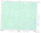
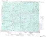
Maps showing Lacs Kanucheshuwanuch, Baie-James; Jamésie, Quebec
Lacs Kanucheshuwanuch is a Lake located in Baie-James; Jamésie, Quebec and has an elevation of 220 meters.
- Latitude: 51° 32' 15'' North (decimal: 51.5376098)
- Longitude: 77° 28' 9'' West (decimal: -77.4691809)
- Topography Feature Category: Lake
- Geographical Feature: Lacs
- Canadian Province/Territory: Quebec
- Elevation: 220 meters
- Location: Baie-James; Jamésie
- Atlas of Canada Locator Map: Lacs Kanucheshuwanuch
- GPS Coordinate Locator Map: Lacs Kanucheshuwanuch Lat/Long
Lacs Kanucheshuwanuch NTS Map Sheets