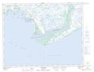
Maps showing Ruisseau Kuahkuetshuahu, Natashquan; Minganie, Quebec
Ruisseau Kuahkuetshuahu is a River located in Natashquan; Minganie, Quebec and has an elevation of 17 meters.
- Latitude: 50° 13' 1'' North (decimal: 50.2170162)
- Longitude: 61° 51' 16'' West (decimal: -61.8545373)
- Topography Feature Category: River
- Geographical Feature: Ruisseau
- Canadian Province/Territory: Quebec
- Elevation: 17 meters
- Location: Natashquan; Minganie
- Atlas of Canada Locator Map: Ruisseau Kuahkuetshuahu
- GPS Coordinate Locator Map: Ruisseau Kuahkuetshuahu Lat/Long
Ruisseau Kuahkuetshuahu NTS Map Sheets