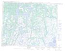
Maps showing Lac Namehat Kakutepapinaniht, Petit-Mécatina; Minganie, Quebec
Lac Namehat Kakutepapinaniht is a Lake located in Petit-Mécatina; Minganie, Quebec and has an elevation of 101 meters.
- Latitude: 50° 35' 7'' North (decimal: 50.5853376)
- Longitude: 59° 56' 0'' West (decimal: -59.9333381)
- Topography Feature Category: Lake
- Geographical Feature: Lac
- Canadian Province/Territory: Quebec
- Elevation: 101 meters
- Location: Petit-Mécatina; Minganie
- Atlas of Canada Locator Map: Lac Namehat Kakutepapinaniht
- GPS Coordinate Locator Map: Lac Namehat Kakutepapinaniht Lat/Long
Lac Namehat Kakutepapinaniht NTS Map Sheets