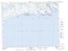
Maps showing Baie Pepihtnahu, Côte-Nord-du-Golfe-du-Saint-Laurent; Basse-Côte-Nord, Quebec
Baie Pepihtnahu is a Bay located in Côte-Nord-du-Golfe-du-Saint-Laurent; Basse-Côte-Nord, Quebec and has an elevation of 0 meters.
- Latitude: 50° 11' 37'' North (decimal: 50.1936801)
- Longitude: 61° 6' 28'' West (decimal: -61.1078425)
- Topography Feature Category: Bay
- Geographical Feature: Baie
- Canadian Province/Territory: Quebec
- Elevation: 0 meters
- Location: Côte-Nord-du-Golfe-du-Saint-Laurent; Basse-Côte-Nord
- Atlas of Canada Locator Map: Baie Pepihtnahu
- GPS Coordinate Locator Map: Baie Pepihtnahu Lat/Long