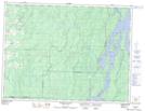
Maps showing Rivière Boucane, Matchi-Manitou; Vallée-de-l'Or, Quebec
Rivière Boucane is a River located in Matchi-Manitou; Vallée-de-l'Or, Quebec and has an elevation of 301 meters.
- Latitude: 48° 36' 35'' North (decimal: 48.6097222)
- Longitude: 77° 7' 38'' West (decimal: -77.1272222)
- Topography Feature Category: River
- Geographical Feature: Rivière
- Canadian Province/Territory: Quebec
- Elevation: 301 meters
- Location: Matchi-Manitou; Vallée-de-l'Or
- Atlas of Canada Locator Map: Rivière Boucane
- GPS Coordinate Locator Map: Rivière Boucane Lat/Long
Rivière Boucane NTS Map Sheets