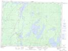
Maps showing Pascalis, Val-d'Or; Vallée-de-l'Or, Quebec
Pascalis is a Unincorporated area located in Val-d'Or; Vallée-de-l'Or, Quebec and has an elevation of 329 meters.
- Latitude: 48° 8' 46'' North (decimal: 48.1461111)
- Longitude: 77° 29' 11'' West (decimal: -77.4863889)
- Topography Feature Category: Unincorporated area
- Geographical Feature: Lieu-dit
- Canadian Province/Territory: Quebec
- Elevation: 329 meters
- Location: Val-d'Or; Vallée-de-l'Or
- Atlas of Canada Locator Map: Pascalis
- GPS Coordinate Locator Map: Pascalis Lat/Long
Pascalis NTS Map Sheets