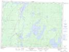
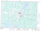
Maps showing Île Tiblemont, Senneterre; Vallée-de-l'Or, Quebec
Île Tiblemont is a Island located in Senneterre; Vallée-de-l'Or, Quebec and has an elevation of 308 meters.
- Latitude: 48° 16' 6'' North (decimal: 48.2683333)
- Longitude: 77° 17' 57'' West (decimal: -77.2991667)
- Topography Feature Category: Island
- Geographical Feature: Île / Ile
- Canadian Province/Territory: Quebec
- Elevation: 308 meters
- Location: Senneterre; Vallée-de-l'Or
- Atlas of Canada Locator Map: Île Tiblemont
- GPS Coordinate Locator Map: Île Tiblemont Lat/Long
Île Tiblemont NTS Map Sheets