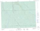
Maps showing Portage Kamagisigoteg, Baie-James; Jamésie, Quebec
Portage Kamagisigoteg is a Road feature located in Baie-James; Jamésie, Quebec.
- Latitude: 50° 8' 40'' North (decimal: 50.1444444)
- Longitude: 78° 55' 38'' West (decimal: -78.9272222)
- Topography Feature Category: Road feature
- Geographical Feature: Portage
- Canadian Province/Territory: Quebec
- Location: Baie-James; Jamésie
- Atlas of Canada Locator Map: Portage Kamagisigoteg
- GPS Coordinate Locator Map: Portage Kamagisigoteg Lat/Long
Portage Kamagisigoteg NTS Map Sheets