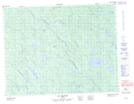
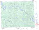
Maps showing Lac Kamwakutisi Uch, Baie-James; Jamésie, Quebec
Lac Kamwakutisi Uch is a Lake located in Baie-James; Jamésie, Quebec.
- Latitude: 50° 33' 40'' North (decimal: 50.5611110)
- Longitude: 78° 11' 47'' West (decimal: -78.1963889)
- Topography Feature Category: Lake
- Geographical Feature: Lac
- Canadian Province/Territory: Quebec
- Location: Baie-James; Jamésie
- Atlas of Canada Locator Map: Lac Kamwakutisi Uch
- GPS Coordinate Locator Map: Lac Kamwakutisi Uch Lat/Long
Lac Kamwakutisi Uch NTS Map Sheets