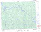
Maps showing Bras Kapakusipastikuch, Baie-James; Jamésie, Quebec
Bras Kapakusipastikuch is a Bay located in Baie-James; Jamésie, Quebec.
- Latitude: 50° 56' 17'' North (decimal: 50.9380556)
- Longitude: 78° 12' 51'' West (decimal: -78.2141667)
- Topography Feature Category: Bay
- Geographical Feature: Bras
- Canadian Province/Territory: Quebec
- Location: Baie-James; Jamésie
- Atlas of Canada Locator Map: Bras Kapakusipastikuch
- GPS Coordinate Locator Map: Bras Kapakusipastikuch Lat/Long
Bras Kapakusipastikuch NTS Map Sheets