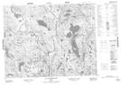
Maps showing Lac Kekanuhkan, Petit-Mécatina; Minganie, Quebec
Lac Kekanuhkan is a Lake located in Petit-Mécatina; Minganie, Quebec.
- Latitude: 51° 0' 41'' North (decimal: 51.0114584)
- Longitude: 60° 58' 10'' West (decimal: -60.9694956)
- Topography Feature Category: Lake
- Geographical Feature: Lac
- Canadian Province/Territory: Quebec
- Location: Petit-Mécatina; Minganie
- Atlas of Canada Locator Map: Lac Kekanuhkan
- GPS Coordinate Locator Map: Lac Kekanuhkan Lat/Long
Lac Kekanuhkan NTS Map Sheets