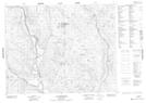
Maps showing Rivière Mahkunipiu, Petit-Mécatina; Minganie, Quebec
Rivière Mahkunipiu is a River located in Petit-Mécatina; Minganie, Quebec.
- Latitude: 51° 36' 25'' North (decimal: 51.6070168)
- Longitude: 61° 50' 29'' West (decimal: -61.8414568)
- Topography Feature Category: River
- Geographical Feature: Rivière
- Canadian Province/Territory: Quebec
- Location: Petit-Mécatina; Minganie
- Atlas of Canada Locator Map: Rivière Mahkunipiu
- GPS Coordinate Locator Map: Rivière Mahkunipiu Lat/Long
Rivière Mahkunipiu NTS Map Sheets